
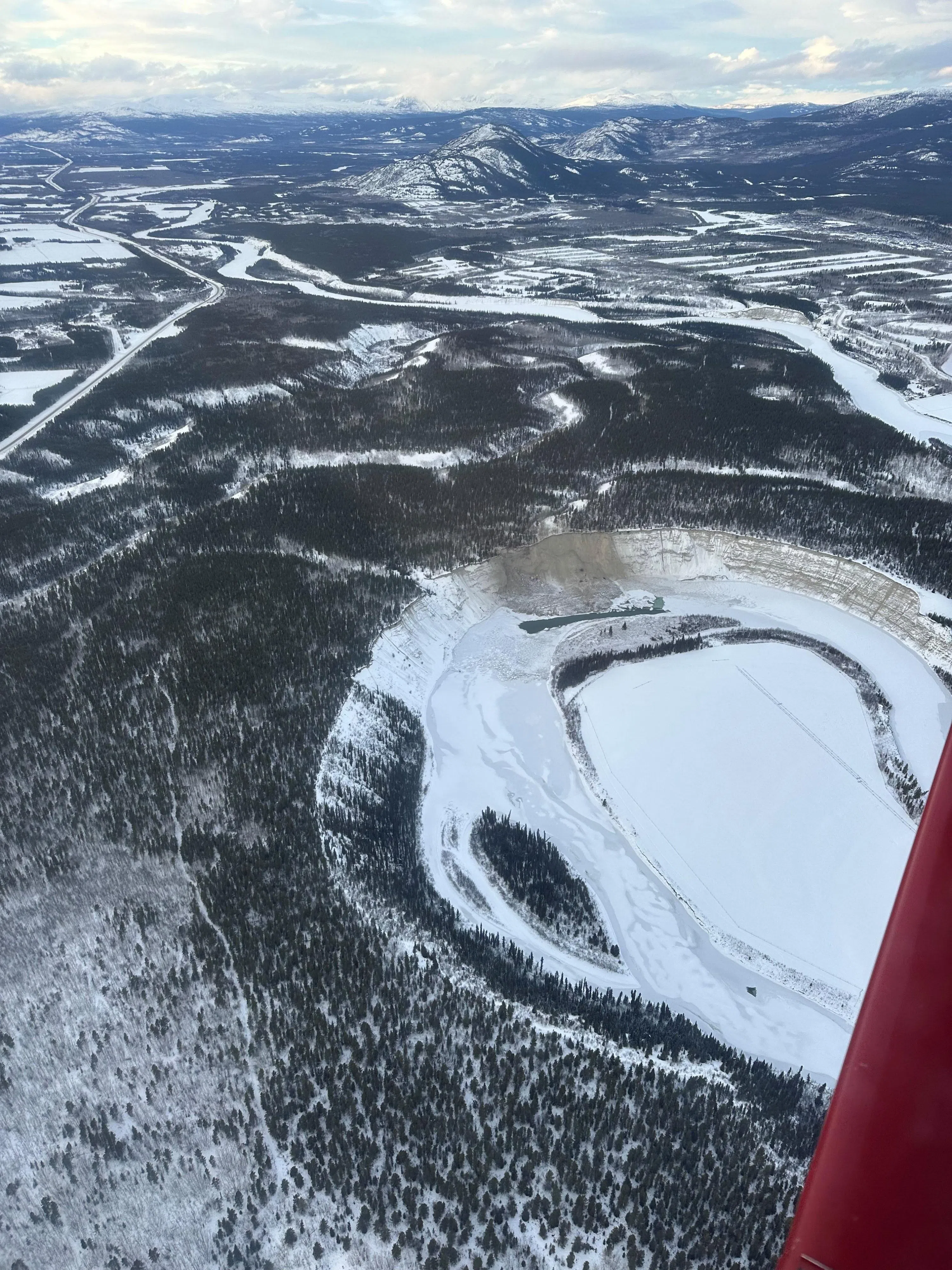
WHITEHORSE, YT – There was a landslide along the Takhini River over the Christmas break, about 13kms upstream as the crow flies from the North Klondike Highway’s Takhini River Bridge.
The Yukon Geological Survey has confirmed the slide took place sometime around December 23rd, and is about 6000 square meters in size, making it one of the largest landslides in recent years along the Takhini River. The slide took place along a Glacial deposit on the banks of the river, about 100 meters away from the site of a slide that took place in 2017.
There have been no reports of any injuries or impacts to local infrastructure, but the Yukon Geological Survey has warned Yukoners recreating in the area to use an alternate route for now, as the river’s course through slide area has been affected, with localized flooding and fast flowing water expected to persist until the slide debris has been eroded by the river.
“I do encourage people to stay away from that slide area. There’s now thin ice below since the slide broke through the river ice, but there’s also the potential for more sliding in the area, and that’s something the Geological Survey and the Water Resources Branch will have a look at.’ – Derek Cronmiller, Head of Surficial Geology with the Yukon Geological Survey
As Derek Cronmiller, Head of Surficial Geology with the Yukon Geological Survey explains, a wave generated by displaced water as the landslide broke through the ice had destroyed some vegetation on a near-by island, and had scattered blocks of river ice around 250 meters away from the footprint of the slide.
‘The footprint of the slide is in the order of 6000 square meters, the area actually affected by the landslide generated wave is somewhere around 2 to 3 times that size. You can see in some images that are circulating online that there’s a lot of river ice that was rafted by this landslide generated wave, and it caused a bit of destruction on the island and pushed those large blocks around 250 meters downstream.’ – Derek Cronmiller, Head of Surficial Geology with the Yukon Geological Survey
Cronmiller and his team will be surveying the area in more detail in the days ahead to get a better understanding of what happened, and to understand any further risks that may persist in the area this year. He notes, slides of this type are unusual in the winter months, but landslides don’t always have an identifiable trigger, and the region is known for thaw slumps and geological activity which he says will continue for millennia to come.


